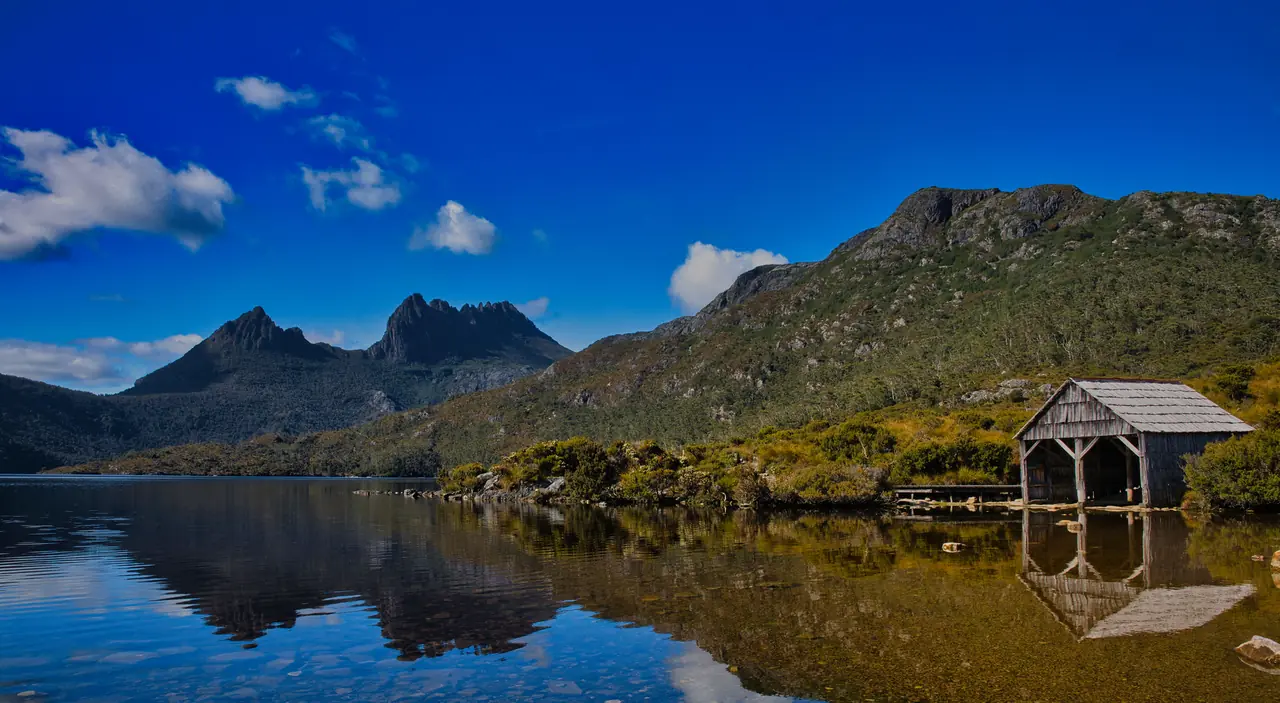
 Cradle Mountain and Dove Lake, Tasmania
Trails map
Walks and rides
Australia's great bushwalks and bikepacking routes on one map. My own trips go on as I write them up.
This map is a starting point, not safety or travel advice. Tracks close for fire, flood and repairs, and bookings and fees change, so check the official page before you go.
The map
Tap a pin or a line for the details, then Zoom in on Google Maps to see the roads and tracks around the start. Or zoom this map into any area and switch to Google Maps there.
Pinch or use the + and − buttons to zoom. On a computer, hold Ctrl (or ⌘) and scroll.
Multi-day walkDay walkBikepacking or rail trailMy tripLines are a rough guide to each route, not a GPS track.
Every trail on the map
The distances and times are the land managers' own figures where they publish them.
Multi-day walks 19
-
Multi-day walk · Western Australia
Bibbulmun Track
- about 1,000 km one way
- 6 to 8 weeks end to end
Kalamunda (Perth Hills) to Albany
Western Australia's great long-distance walk, through the jarrah and karri forests, farmland and south coast of the south-west, with campsites and shelters roughly a day's walk apart.
Before you go
- Most people walk it in sections. End to end takes about six to eight weeks.
- Spring brings the wildflowers. Summer is hot with high fire danger, so check for closures before you go.
-
Multi-day walk · Western Australia
Cape to Cape Track
- about 135 km one way
- 5 to 8 days
Cape Naturaliste to Cape Leeuwin
A coastal walk between two lighthouses in the Margaret River region, along cliffs and beaches and through the Boranup karri forest.
Before you go
- Open all year. Spring (September to November) brings wildflowers and whales; summer is hot and dry, so carry extra water.
-
Multi-day walk · Northern Territory
Jatbula Trail
- 62 km one way
- 4 to 6 days
Nitmiluk Gorge to Leliyn (Edith Falls)
Runs along the western edge of the Arnhem Land escarpment in Nitmiluk National Park, past waterfalls and swimming holes, and finishes at Leliyn (Edith Falls).
Before you go
- The walking season is 1 June to 30 September, and only a small number of walkers can start each day.
- Bookings open early in the year and sell out fast. For 2026 they opened on 3 February.
- The walk starts with a ferry across the Katherine River, booked through Nitmiluk Tours.
Figures from NT Parks and Wildlife, checked October 2026.
-
Multi-day walk · Northern Territory
Larapinta Trail
- about 230 km one way
- 12 sections, often 2 to 3 weeks
Alice Springs Telegraph Station to Mt Sonder
Follows the spine of the West MacDonnell Ranges (Tjoritja) west from Alice Springs, through gorges and past waterholes, and finishes on the summit of Mt Sonder, the trail's highest point.
Before you go
- Walk it in the cooler months, roughly May to September. Summer heat out here is dangerous.
- You can do it end to end or in sections: roads reach the trail at many of the section ends.
- Check NT Parks for camping fees and track closures before you go.
Figures from NT Parks and Wildlife, checked October 2026.
-
Multi-day walk · South Australia
Heysen Trail
- 1,200 km one way
- Most walk it in sections
Cape Jervis to Parachilna Gorge
One of Australia's longest walking trails: from the Fleurieu Peninsula coast through the Mount Lofty Ranges, the Barossa and the Mid North to the Flinders Ranges.
Before you go
- Most of the trail closes in the fire danger season, usually November to April. The 80 km from Cape Jervis to Victor Harbor (the Wild South Coast Way) stays open all year except on catastrophic fire danger days.
- Check the Friends of the Heysen Trail site for closures and reroutes before you go.
Figures from the Friends of the Heysen Trail, checked October 2026.
-
Multi-day walk · South Australia
Kangaroo Island Wilderness Trail
- 66 km one way
- 5 days
- Class 4
Flinders Chase Visitor Centre to Kelly Hill Caves
A booked walk through Flinders Chase National Park and along the wild south-west coast of Kangaroo Island.
Before you go
- You need to book and pay a trail fee before you walk.
- The best time to go is March to November.
Figures from National Parks and Wildlife Service South Australia, checked October 2026.
-
Multi-day walk · Queensland
K'gari Great Walk
- about 90 km one way
- 6 to 8 days
Dilli Village to Happy Valley
Rainforest, sand blows and perched freshwater lakes on K'gari, the world's largest sand island, past Lake McKenzie and Lake Wabby.
Before you go
- You need camping permits for the walkers' camps (book online), with a limit of two nights in a row at each.
- Dingoes (wongari) live on the island: never walk alone, and use the food storage boxes at camp.
- Reach the island by barge from Rainbow Beach or Hervey Bay.
Figures from Queensland Parks and Wildlife Service, checked October 2026.
-
Multi-day walk · Queensland
Thorsborne Trail
- 32 km one way
- 3 to 5 days
Ramsay Bay to George Point, Hinchinbrook Island
A rugged walk down the east coast of Hinchinbrook Island, past waterfalls, rainforest and empty beaches. You reach the island by boat.
Before you go
- Permits are released once a year and are very limited: from 2027, 12 independent walkers can start each day.
- The trail is closed from 1 January to 28 February.
- Estuarine crocodiles live here: read the park's safety notes.
Figures from Queensland Parks and Wildlife Service, checked October 2026.
-
Multi-day walk · New South Wales
Great North Walk
- 250 km one way
- About 2 weeks
Sydney (Macquarie Place) to Newcastle
Made for the 1988 Bicentenary, it links Sydney Harbour with Newcastle through the bush of the Hawkesbury, the Central Coast hinterland and the Watagans.
Before you go
- There's no single official website: Crown Lands sells the official map kit.
- Most people walk it in sections, using the train stations along the way.
-
Multi-day walk · New South Wales
Light to Light Walk
- 32 km one way
- 2 to 3 days
- Grade 4
Boyds Tower to Green Cape Lighthouse, near Eden
A Sapphire Coast walk through Beowa National Park, from the historic Boyds Tower past red Devonian rock platforms, quiet beaches and whale lookouts to Green Cape Lighthouse, the southernmost lighthouse in NSW.
Before you go
- The usual plan is 3 days: book a tent platform at the hike-in campgrounds at Mowarry Point and Hegartys Bay.
- Some creek crossings around Saltwater Creek can mean wet feet, depending on the tide.
- The track is well marked but remote in places: carry a topographic map and compass, or a GPS.
- It's one way, so book a transfer or arrange a car shuffle.
Figures from NSW National Parks, checked October 2026.
-
Multi-day walk · New South Wales
Six Foot Track
- 42 km one way
- 3 days
- Hard
Katoomba to Binda Bush Cabins (normally Jenolan Caves)
An 1884 bridle track from the Explorers Tree at Katoomba, down through the Megalong Valley, over the Coxs River on a swing bridge and across the Black Range.
Before you go
- The track now ends at Binda Bush Cabins while the Jenolan Karst Conservation Reserve is closed.
- Book a campsite or register before you go, and arrange transport from the end: there's no public transport.
Figures from NSW National Parks, checked October 2026.
-
Multi-day walk · Victoria, New South Wales, Australian Capital Territory
Australian Alps Walking Track
- about 650 km one way
- Up to 10 weeks
Walhalla to Tharwa, near Canberra
The long walk through Australia's high country, following ridges and high plains through the Baw Baw, Alpine, Kosciuszko and Namadgi national parks, mostly far from any town.
Before you go
- For experienced, self-reliant walkers with good navigation skills: much of it is remote and unmarked.
- Carry enough water for two days. Fuel-stove-only areas and permits apply in places.
- Many people walk shorter sections, such as the Baw Baw Plateau, the Bogong High Plains or the Jagungal Wilderness.
Figures from the Australian Alps national parks, checked October 2026.
-
Multi-day walk · Victoria
Grampians Peaks Trail
- 160 km one way
- 13 days, 12 nights
- Grade 4
Mt Zero to Dunkeld, via Halls Gap
A peak-to-peak walk the length of the Grampians (Gariwerd) National Park, from Mt Zero in the north through Halls Gap to Dunkeld, with hike-in campgrounds and some hiker huts.
Before you go
- Book the hike-in campgrounds through Parks Victoria. Shorter three-day sections are popular.
- Parts of the park are still recovering from the 2024-25 bushfires, so check what's open before you go.
Figures from Parks Victoria, checked October 2026.
-
Multi-day walk · Victoria
Great Ocean Walk
- about 100 km one way
- 8 days
Apollo Bay to the Twelve Apostles
Tall Otway forest, coastal heath, wild beaches, river crossings and windswept clifftops along the Great Ocean Road coast, with hike-in campgrounds a day's walk apart.
Before you go
- Book the hike-in campgrounds before you walk.
- Plan around the tides and the weather on the beach sections.
- Arrange your transport back from the Twelve Apostles.
Figures from the Great Ocean Road Coast and Parks Authority, checked October 2026.
-
Multi-day walk · Victoria
Wilsons Prom Southern Circuit
- about 35 to 60 km loop
- 2 to 4 days
Loop from Telegraph Saddle
Granite headlands and white-sand coves at the southern tip of the mainland: Sealers Cove, Refuge Cove and Waterloo Bay, with the lighthouse as a longer option.
Before you go
- Overnight hikes need a booked permit from Parks Victoria.
- The distance depends on the loop you pick: going via the lighthouse makes it the longest.
-
Multi-day walk · Tasmania
Freycinet Peninsula Circuit
- 27 km loop
- 2 to 3 days
- Grade 3
Loop from the Wineglass Bay car park
A loop around the Freycinet Peninsula past Hazards Beach, Cooks Beach and Bryans Beach, then over Mt Graham and down to Wineglass Bay.
Before you go
- Walk it anticlockwise from the Wineglass Bay car park, as the walk notes ask: it helps stop the spread of root rot.
- Water at Hazards Beach can be unreliable, so boil it.
- No campfires, and you need a parks pass.
Figures from Parks and Wildlife Service Tasmania, checked October 2026.
-
Multi-day walk · Tasmania
Overland Track
- 65 km one way
- 6 days
- Grade 4
Cradle Mountain to Lake St Clair
Tasmania's best-known alpine walk, through the Cradle Mountain-Lake St Clair National Park. Side trips lead to waterfalls and summits, including Mt Ossa (1617 m), Tasmania's highest peak.
Before you go
- From 1 October to 31 May you must book, pay a fee and walk north to south. Only 34 walkers can start each day, so popular dates sell out.
- Outside that season it's a free registration and you can walk either way.
- Almost half the track is above 1000 m and exposed to the weather.
- Most walkers finish at Narcissus Hut and take the ferry (booked separately) to the Lake St Clair Visitor Centre, or walk the extra 17.5 km along the lake.
Figures from Parks and Wildlife Service Tasmania, checked October 2026.
-
Multi-day walk · Tasmania
South Coast Track
- 85 km one way
- 6 to 8 days
- Grade 4
Melaleuca to Cockle Creek
A remote, rough walk along Tasmania's wild southern coastline in the Southwest National Park: windswept beaches, rocky headlands, mountain ranges and plenty of mud.
Before you go
- Most walkers fly in to Melaleuca by light plane and walk out to Cockle Creek, about 2.5 hours' drive south of Hobart.
- Weather often delays the flights, so carry spare food.
- You need a parks pass, and the South Coast Walk map and notes are strongly advised.
Figures from Parks and Wildlife Service Tasmania, checked October 2026.
-
Multi-day walk · Tasmania
Three Capes Track
- 48 km one way
- 4 days, 3 nights
- Grade 3
Port Arthur (boat to Denmans Cove) to Fortescue Bay
A hut-based walk on the Tasman Peninsula through tall eucalypt forest and coastal heath, past Australia's highest sea cliffs to Cape Pillar and Cape Hauy. Nights are in the Surveyors, Munro and Retakunna cabins.
Before you go
- Book ahead. The fee includes the cabins and your parks pass, and the walk starts with a boat trip from Port Arthur.
- Fuel stoves only, all year.
- The track closes for two weeks each April for maintenance (5 to 18 April in 2027).
Figures from Parks and Wildlife Service Tasmania, checked October 2026.
Day walks 13
-
Day walk · Western Australia
Bluff Knoll
- 6.8 km return
- 3 to 4 hours
Return from the Bluff Knoll car park, Stirling Range National Park
A steep climb with many steps to the top of Bluff Knoll (1099 m), the most popular walk in the Stirling Range, with views all around.
Before you go
- It's often much colder and windier on top, so take a warm jacket.
- You need a park pass. Stay off the trails on days of extreme fire danger.
Figures from Parks and Wildlife Service WA, checked October 2026.
-
Day walk · Western Australia
Dales Gorge, Karijini
- 2.4 km rim walk
- 1 to 3 hours
From the Dales Gorge day-use area
Fortescue Falls, Fern Pool and the Gorge Rim Walk, which follows the edge of Dales Gorge between the Circular Pool and Fortescue Falls lookouts.
Before you go
- The trails down into the gorge are steep, and some close after rain or rockfalls: check park alerts.
- You need a park pass.
Figures from Parks and Wildlife Service WA, checked October 2026.
-
Day walk · Northern Territory
Kings Canyon Rim Walk
- 6 km loop
- 3 to 4 hours
- Grade 4
Loop from the Kings Canyon car park, Watarrka National Park
A steep climb to the rim of Kings Canyon, then a loop around the sandstone domes with views straight down into the gorge and the Garden of Eden waterhole.
Before you go
- On days forecast to reach 36°C or more you must start before 9 am. The walk is closed after that.
- In the hotter months (September to April) avoid the middle of the day and carry plenty of water.
Figures from Tourism NT, checked October 2026.
-
Day walk · Northern Territory
Uluṟu base walk
- 10.6 km loop
- 3.5 hours
- Grade 3
All the way around Uluṟu
A flat walk around the whole base of Uluṟu, past waterholes, rock art and sacred sites. Walk it in one go or a section at a time.
Before you go
- In hot weather, walk in the cooler morning and finish before 11 am.
- Some places are sacred: please respect the signs that ask you not to take photos.
- You need a park pass.
Figures from Parks Australia, checked October 2026.
-
Day walk · Northern Territory
Valley of the Winds
- 7.4 km loop
- 3 to 4 hours
- Grade 4
Loop from the Valley of the Winds car park, Kata Tjuṯa
A steep, rocky loop between the great domes of Kata Tjuṯa, with two lookouts, Karu and Karingaṉa.
Before you go
- When it's 36°C or hotter, the walk closes past Karu Lookout from 11 am.
- Shorter options: Karu Lookout (2.2 km return) or Karingaṉa Lookout (5.4 km return).
Figures from Parks Australia, checked October 2026.
-
Day walk · South Australia
St Mary Peak and Tanderra Saddle
- 14.6 to 21.5 km return or loop
- 6 to 9 hours
- Grade 4
From Wilpena Pound (Ikara)
The big climb at Wilpena Pound. The Adnyamathanha people ask walkers not to climb to the summit, which is central to their creation story, so Tanderra Saddle is the place to turn around.
Before you go
- Closed from 30 November to 1 March each year.
- Start by 9 am (10 am in daylight saving) and carry at least four litres of water.
- All trails in the park close on days of catastrophic fire danger.
Figures from Walking SA and National Parks SA, checked October 2026.
-
Day walk · Queensland
Carnarvon Gorge
- 19.4 km return
- About 8 hours
- Grade 4
Main gorge track, visitor area to Big Bend
Up the floor of the gorge under white sandstone cliffs, with side tracks to the Moss Garden, the Amphitheatre and Aboriginal rock art.
Before you go
- The track crosses the creek many times on stepping stones.
- Walk to the far end first and do the side tracks on the way back.
- Big Bend has a walkers' camp if you'd rather stay the night.
Figures from Queensland Parks and Wildlife Service, checked October 2026.
-
Day walk · New South Wales
Grand Canyon Track
- 6.3 km loop
- 3 to 4 hours
- Grade 3
Loop from Evans Lookout, Blackheath
Steps down into a deep, ferny slot canyon below the sandstone cliffs of the Blue Mountains, then back up to the lookout.
Before you go
- Many steps, and the creek crossings can be slippery.
- There's no drinking water, so bring your own.
Figures from NSW National Parks, checked October 2026.
-
Day walk · New South Wales
Main Range Walk
- 22 km loop
- 7 to 9 hours
- Grade 4
Loop from Charlotte Pass, over Mt Kosciuszko
The classic walk across Australia's roof: glacial lakes, the headwaters of the Snowy River and the summit of Mt Kosciuszko (2228 m), the highest point on the mainland.
Before you go
- Best from December to March, after the snow melts. It's snowbound from June to October.
- The road to Charlotte Pass is closed in winter, and park entry fees apply.
- Steep in places and exposed, with no drinking water on the way.
Figures from NSW National Parks, checked October 2026.
-
Day walk · Victoria
Mt Feathertop via the Razorback
- 22 km return
- 7 to 9 hours
- Hard
Return from Diamantina Hut, near Mt Hotham
A high ridge walk, above the trees most of the way, to Victoria's second-highest peak. Federation Hut near the top makes it a good overnighter too.
Before you go
- Best from November to April, when it's free of snow.
- Very exposed to the weather. In winter it's only for experienced alpine walkers.
- You can finish down the Bungalow Spur to Harrietville instead, about 10 km.
Figures from Hotham Alpine Resort, checked October 2026.
-
Day walk · Victoria
The Pinnacle, Grampians
- 4.2 km return
- 1.5 to 3 hours
Return from the Wonderland car park, Halls Gap
Up through the Grand Canyon and Silent Street to the Pinnacle lookout, high above Halls Gap.
Before you go
- Steep and rocky, and slippery when wet.
- The car park fills early on busy days.
-
Day walk · Tasmania
Cape Hauy
- 9.4 km return
- 4 hours
- Grade 3
Return from Fortescue Bay
Through heath and woodland to the sea cliffs of Cape Hauy and its dolerite columns, including the Totem Pole and the Candlestick.
Before you go
- Lots of steps, and you feel them on the way back.
- You need a parks pass.
Figures from Parks and Wildlife Service Tasmania, checked October 2026.
-
Day walk · Tasmania
Cradle Mountain summit
- 12.8 km return
- 8 hours
- Grade 5
Return from Dove Lake
A hard day to the top of Cradle Mountain (1545 m), with 600 m of climbing and a scramble over big boulders at the end.
Before you go
- Take the shuttle bus from the Cradle Mountain Visitor Centre: you need a parks pass and a shuttle ticket.
- The summit is exposed. Turn back if the weather comes in.
Figures from Parks and Wildlife Service Tasmania, checked October 2026.
Bikepacking and rail trails 10
-
Bikepacking route · Western Australia
Gibb River Road
- about 660 km mostly gravel
Derby to the Great Northern Highway, near Kununurra
The Kimberley's famous outback road, past gorges, cattle stations and big river crossings such as the Pentecost.
Before you go
- Dry season only: the wet, roughly November to March, can close it.
- Heavy corrugations and long gaps between stations and roadhouses, so plan water and food carefully.
-
Bikepacking route · Western Australia
Munda Biddi Trail
- about 1,000 km one way
- 2 to 3 weeks
Mundaring to Albany
An off-road cycling trail through the forests of WA's south-west on singletrack, forest roads and gravel, with purpose-built campsites along the way.
Before you go
- Best on a mountain bike or a gravel bike with wide tyres.
- Check the Foundation's route diversions before you ride.
Figures from the Munda Biddi Trail Foundation, checked October 2026.
-
Bikepacking route · South Australia
Mawson Trail
- about 900 km one way
Adelaide Hills to Blinman
Back roads, fire tracks and farm tracks from the Adelaide Hills through the Barossa, Kapunda and Burra into the Flinders Ranges, named after the explorer Sir Douglas Mawson.
I toured the Mawson Trail in 2013 and filmed it: Bicycle Touring the Flinders Ranges.
Before you go
- Made for mountain bikes or sturdy touring bikes, not road bikes.
- Heavy rain can make the dirt sections very slow or impassable.
- The official route maps come as a set of nine.
Figures from the Office for Recreation, Sport and Racing SA, checked October 2026.
-
Bikepacking route · South Australia
Oodnadatta Track
- about 620 km unsealed
Marree to Marla, via William Creek and Oodnadatta
An outback dirt road along the western shores of Kati Thanda-Lake Eyre, following the old Ghan railway line past ruined sidings and mound springs.
Before you go
- Check the road is open before you go: it closes after rain.
- Long gaps between water and food: about 200 km from William Creek to Oodnadatta with no services.
-
Bikepacking route · Queensland
Brisbane Valley Rail Trail
- 161 km
Wulkuraka (Ipswich) to Yarraman
Australia's longest rail trail, on the old Brisbane Valley railway line through farm country and small towns such as Esk and Toogoolawah.
Before you go
- Mostly compacted gravel: hybrid and mountain bikes suit it best.
- Shared with walkers and horse riders.
Figures from Queensland Transport and Main Roads, checked October 2026.
-
Bikepacking route · Queensland, New South Wales, Australian Capital Territory, Victoria
National Trail (Bicentennial National Trail)
- 5,330 km one way
Cooktown to Healesville
One of the longest non-motorised trails in the world, down the Great Dividing Range from Cooktown in far north Queensland to Healesville near Melbourne, for walkers, cyclists and horse riders. It's mapped in 12 sections.
The map shows the two ends.
Before you go
- You need to be fully self-reliant: plan water and resupply carefully.
- Spring and autumn are the most pleasant times to ride it.
Figures from the National Trail, checked October 2026.
-
Bikepacking route · Victoria
Great Victorian Rail Trail
- 134 km
Tallarook to Mansfield, with a branch to Alexandra
Victoria's longest rail trail, through farmland and river valleys past Yea and across Lake Eildon at Bonnie Doon, with the old Cheviot Tunnel near Yea.
Before you go
- A gravel trail you can walk, ride or take a horse on.
- The tunnel is cool on a hot day; bring a light.
Figures from the Great Victorian Rail Trail, checked October 2026.
-
Bikepacking route · Victoria
High Country Rail Trail
- about 80 km
Wodonga to Shelley, along Lake Hume
From Wodonga along 30 km of Lake Hume foreshore to Tallangatta, then up into the hills to Shelley, once the highest railway station in Australia.
Before you go
- The section from Tallangatta to Old Tallangatta is sealed. Parts of the climb to Shelley are rough fire trail, for mountain bikes only.
- Start at Shelley and you can freewheel 20 km downhill through the forest.
Figures from the High Country Rail Trail, checked October 2026.
-
Bikepacking route · Victoria
Murray to Mountains Rail Trail
- 100+ km sealed
Wangaratta to Bright, with branches to Beechworth and Yackandandah
A sealed rail trail through the vineyards, farms and valleys of north-east Victoria, finishing in the mountains at Bright.
Before you go
- Mostly gentle, but the branch up to Beechworth climbs most of the way.
Figures from the Rural City of Wangaratta, checked October 2026.
-
Bikepacking route · Tasmania
Tasmanian Trail
- about 480 km one way
Devonport to Dover
A multi-use trail for cyclists, walkers and horse riders, the length of Tasmania from Bass Strait to the far south, mostly through state forest and reserves on gravel roads, fire trails and farm tracks.
Before you go
- Some sections cross private land: you need to be a member of the Tasmanian Trail Association and book keys in advance.
- Check the Association's track notices for burns and closures.
Figures from the Tasmanian Trail Association, checked October 2026.
My trips 4
-
My trip · Northern Territory
The Red Centre by fat bike
Trip page being written
Six hundred kilometres to the heart of the continent in 2025: red sand, rocky tracks and vast open country.
-
My trip · Queensland
Outback Queensland
Trip page being written
Long gravel roads and big skies around Boulia.
-
My trip · Victoria
The Victorian High Country
Trip page being written
Fire trails, snow gums and ridge-top camps around Bogong, Hotham, Mt Buffalo and Mt Buller.
-
My trip · Tasmania
Tasmania
Trip page being written
Freycinet, the sea cliffs of the Tasman Peninsula, Cradle Mountain, and one unforgettable aurora night.
About this map
The famous trails come first. My own rides and walks are the navy stars, and each one will get a trip page with the real details: where I camped, where I found water and what went wrong. When I have the GPS track, the rough line on the map becomes the real one.
The lines here run through the main places on each route, so treat them as a guide to where a trail goes, not a track to follow. For the real tracks and roads, zoom in on Google Maps: it only loads when you ask for it, so nothing goes to Google until then. Coastline and state borders are from Natural Earth. Facts checked October 2026.